
TRAVEL TIPS: cleveland way, north yorkshire
Embark on an unforgettable adventure through one of England's most breathtaking landscapes: the Cleveland Way National Trail. Winding its way across the stunning North York Moors National Park and along the dramatic North Yorkshire coastline, this iconic long-distance footpath offers an incredible diversity of scenery. From heather-clad moorlands and ancient woodlands to soaring clifftops and charming fishing villages, the Cleveland Way promises panoramic views, rich history, and an exhilarating walking experience for seasoned hikers and keen ramblers alike. Get ready to discover the wild beauty of North Yorkshire on foot.
history of the cleveland way
The Cleveland Way, located in North Yorkshire, is one of England's earliest and most beloved National Trails. The idea for a long-distance path linking the region's diverse landscapes first emerged in the 1930s, championed by the Teesside Ramblers' Association. They envisioned a route connecting the Hambleton Drove Road, the Cleveland escarpment, and coastal footpaths.
A formal proposal for the trail was submitted in 1953 by the National Parks Commission. After years of planning and development, the Cleveland Way was officially opened on May 24, 1969, making it only the second National Trail to be established in England and Wales (the first being the Pennine Way).
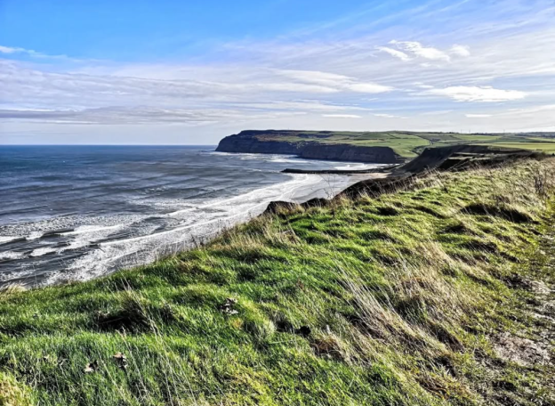
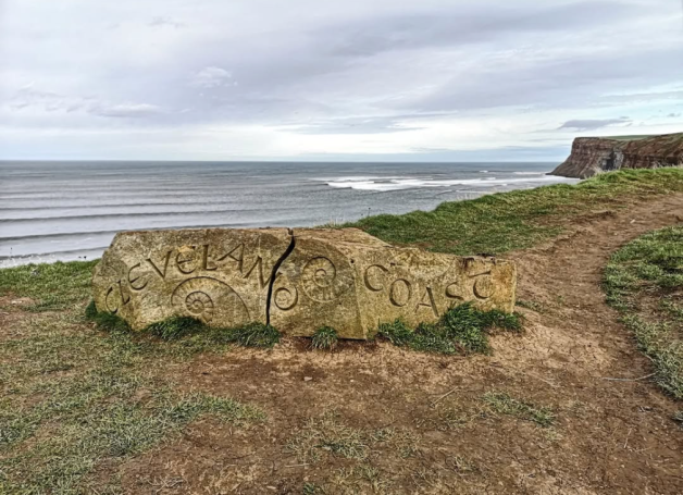
The 109-mile (175 km) horseshoe-shaped route was designed to showcase the incredible variety of the North York Moors National Park, stretching from the market town of Helmsley, across the inspirational heather-clad moors, to the dramatic coastline at Saltburn-by-the-Sea. From there, it follows the rugged North Yorkshire coast southwards to Filey, passing through charming fishing villages and vibrant seaside towns, offering a journey through rich natural beauty, history, and heritage.
before you arrive
route planning
- Full Trail: The entire Cleveland Way is 109 miles (175 km) long. Most people complete it in 7-10 days, averaging 10-15 miles per day.
- Sections: Don't feel obliged to do the whole thing. You can walk popular sections as day trips or plan shorter multi-day walks. Popular sections include the coastal stretch from Saltburn to Whitby or the moorland section around Sutton Bank.
- Direction: The official route starts in Helmsley and ends in Filey, offering a logical progression from inland moors to the coast. This direction is generally recommended as it puts the prevailing wind behind you on the coastal sections. (Map one below shows the start/end in Helmsley & map two shows the start/end in Filey).
shorter routes of the trail
The Cleveland Way offers numerous fantastic shorter sections, perfect for a day walk or a weekend trip. Many of these are accessible via public transport, allowing for convenient linear walks, while others can be easily adapted into circular routes.
Linear (Point-to-Point) Walks
whitby > Robin Hood's bay (vise versa)
- Distance: Approximately 6.8 miles (11 km)
- Time: 2.5-3 hours
- Highlights: Iconic coastal scenery, the famous Whitby Abbey, charming cobbled streets of Robin Hood's Bay, and dramatic clifftops.
- Logistics: Easily walked one-way with a convenient bus service connecting the two towns. The bus drops you centrally in Whitby and picks up near Hotel Victoria in Robin Hood's Bay. Tip: One way can be walked via Cleveland Way and the return could be walked via The Cinder Track to add some variety to the walk.
A highly recommended route, tried and tested by us – and given the paw print of approval!
Helmsley > sutton bank (vise versa)
- Distance: Approximately 10-10.5 miles (16-17 km)
- Time: 4-5 hours
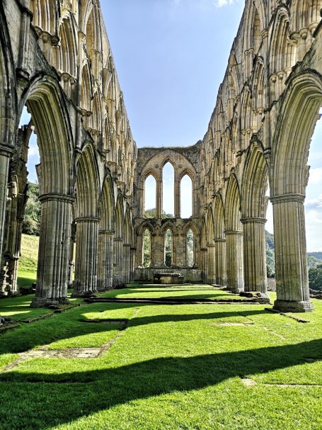
- Highlights: A gentle start to the Cleveland Way, passing Helmsley Castle and the impressive Rievaulx Abbey (a short detour). Ends at Sutton Bank, known for "England's Finest View" over the Vale of Mowbray.
- Logistics: Bus services connect Helmsley and Sutton Bank, making this a good linear option.
saltburn-by-the-sea > staithes (vise versa)
- Distance: Approximately 7-8 miles (11-13 km)
- Time: 3-4 hours
- Highlights: Dramatic cliff-top walking, Boulby Cliff (England's highest cliff on the east coast), and the picturesque, historic fishing village of Staithes with its narrow ginnels and charming harbour.
- Logistics: Bus services connect Saltburn and Staithes.
ravenscar > robin hood's bay (vise versa)
- Distance: Approximately 4-5 miles (6.5-8 km)
- Time: 1.5-2.5 hours
- Highlights: Stunning coastal views, the "town that never was" at Ravenscar (an abandoned Victorian resort development), and a quieter stretch of coastline.
- Logistics: Can be walked one-way with a bus service between the two points, though less frequent than the Whitby-Robin Hood's Bay route. Tip: There is free parking available in Ravenscar, so it is recommended to start here to take advantage of this. Tip: For our return leg, we switched from the Cleveland Way to The Cinder Track after walking one way; this proved to be an excellent choice that we'd recommend.
A highly recommended route, tried and tested by us – and given the paw print of approval!
Osmotherley > Clay Bank Top (vise versa)
- Distance: Approximately 11-11.5 miles (18-18.5 km)
- Time: 5-6 hours
- Highlights: Considered one of the most strenuous but rewarding sections, traversing the "roller-coaster" Cleveland Hills with excellent views across the moors.
- Logistics: Requires careful planning for transport at Clay Bank Top as it's more remote.
helmsley > Rievaulx (vise versa)
- Distance: Approximately 3.5 miles (5.6 km) one-way.
- Time: Around 1.5 - 2 hours one-way.
- Highlights: This picturesque walk takes you directly from the charming market town of Helmsley, past the imposing Helmsley Castle, and then through beautiful woodland and along the River Rye to the magnificent ruins of Rievaulx Abbey. It's a truly stunning journey through history and tranquil nature.
- Logistics: You start directly from Helmsley town centre. Upon reaching Rievaulx Abbey, you can either walk back to Helmsley (making it a 7-mile round trip) or arrange for a taxi from Rievaulx to return to Helmsley. There isn't a direct public bus service between Rievaulx and Helmsley, so a return walk or pre-booked taxi is your best option. Tip: If you are an English Heritage member, there is free parking available at Rievaulx Abbey.
A highly recommended route, tried and tested by us – and given the paw print of approval!
skinningrove > saltburn-by-the sea (vise versa)
- Distance: Approximately 5.5-6 miles (8.8-9.6 km) one-way.
- Time: Around 2.5 - 3 hours one-way.
- Highlights: This challenging but rewarding section of the Cleveland Way showcases the rugged beauty of the North Yorkshire coast. You'll pass remnants of the area's rich mining heritage, encounter impressive cliffs and unique geological features, and enjoy expansive views out over the North Sea. The walk culminates in the Victorian grandeur of Saltburn-by-the-Sea, with its iconic pier, charming funicular railway, and sandy beach.
- Logistics: This walk is easily managed as a one-way trip thanks to public transport. You can start in Skinningrove (check local bus services for connections, often from Loftus or Brotton). Upon finishing in Saltburn, you can catch a local bus directly back towards Skinningrove or connecting hubs, or even use the train station in Saltburn for wider connections. Tip: there is limited, free parking available in Skinningrove, which is why we recommend starting here.
A highly recommended route, tried and tested by us – and given the paw print of approval!
runswick bay > staithes (vise versa)
- Distance: Approximately 3-4 miles (5-6.5 km) one-way.
- Time: Around 1.5 - 2 hours one-way.
- Highlights: This captivating coastal walk takes you from the beautiful, sheltered fishing village of Runswick Bay, climbing up to the clifftops to offer stunning sea views. You'll pass dramatic coastline before descending into the equally picturesque, historic fishing village of Staithes, known for its narrow ginnels and charming harbour, once home to Captain Cook.
- Logistics: You can start your walk in either village. Both Runswick Bay and Staithes have local parking available. A bus service (Arriva X4) connects the two villages, allowing you to walk one-way and easily catch a bus back to your starting point.
Circular Routes
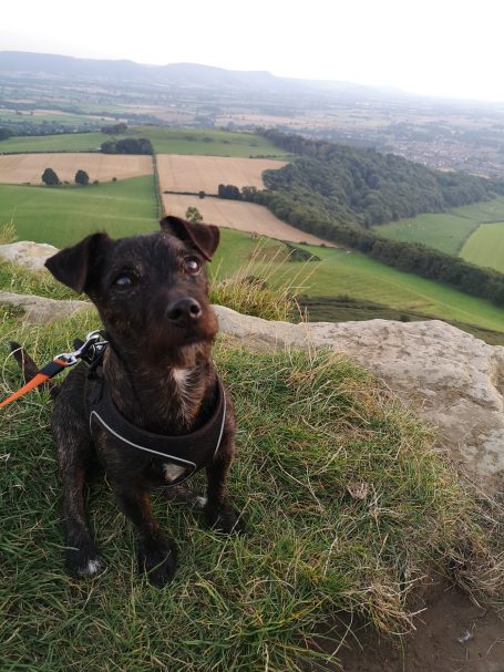
Roseberry Topping & Captain Cook's Monument
- Distance: Varies, typically 6-9 miles (10-14 km) depending on loops.
- Time: 3-5 hours
- Highlights: An iconic, distinctive hill often called "Yorkshire's Matterhorn" (Roseberry Topping), panoramic views, and the monument to Captain Cook. The Cleveland Way skirts Roseberry Topping, but a detour to the summit is highly recommended.
- Parking: Limited free parking is available at Gribdale Gate - Capt Cooks Car Park. There is also paid parking available at the foot of Roseberry Topping.
A highly recommended route, tried and tested by us – and given the paw print of approval!
sutton bank & kilburn white horse
- Distance: Various options, from short strolls to 6-8 miles (10-13 km).
- Time: 2-4 hours
- Highlights: "England's Finest View" from Sutton Bank, the impressive chalk-cut Kilburn White Horse, and woodlands.
- Logistics: Starts from Sutton Bank National Park Centre, with ample paid parking and facilities.
A highly recommended route, tried and tested by us – and given the paw print of approval!
runswick bay & kettleness
- Distance: Around 5-6 miles (8-10 km).
- Time: 2.5-3 hours
- Highlights: Explore the charming, sheltered fishing village of Runswick Bay, dramatic coastal paths, and potentially discover fossils at Kettleness.
- Logistics: Starts from Runswick Bay, with limited parking.
when to visit the cleveland way
- Spring (April-May): Generally good weather, fewer crowds, and wildflowers. Can still be chilly, especially on the moors.
- Summer (June-August): Warmest weather, but also the busiest. The heather on the moors blooms in late August/early September, offering a spectacular purple carpet.
- Autumn (September-October): Beautiful colours, especially on the moors, and fewer crowds than summer. Weather can be more unpredictable.
- Winter (November-March): Only for experienced, well-equipped walkers. Shorter days, potential for snow and ice, and many facilities may be closed.
accommodation
Booking your accommodation in advance is highly recommended.
- Popularity: The Cleveland Way is a popular trail, so B&Bs, guesthouses, pubs with rooms, and campsites, especially in smaller villages, can book up quickly.
- Variety: Options range from luxurious hotels to budget-friendly hostels and campsites. Farm stays can offer a unique experience.
- Baggage Transfer Services: Many companies offer daily baggage transfer between accommodations, allowing you to walk with just a daypack. Book this well in advance.
Preparing yourself
- Footwear: Invest in good quality, waterproof, and well-broken-in hiking boots with ankle support. Bring comfortable socks (liner socks can prevent blisters) and spare pairs.
- Clothing: Layering is key. Pack breathable, moisture-wicking base layers, insulating mid-layers (fleece), and a waterproof and windproof outer shell. Even in summer, a warm layer is essential for exposed sections.
all the gear
- Backpack: Comfortable daypack (for daily essentials) or a larger pack if carrying all your gear.
- Water Bottle/Hydration Pack: Crucial, especially on moorland sections where water sources are scarce.
- First-Aid Kit: Blister plasters, pain relievers, antiseptic wipes, any personal medications.
- Map and Compass/GPS: OS Explorer maps OL26 (North York Moors Western Area) and OL27 (North York Moors Eastern Area) cover the trail. Don't rely solely on phone GPS.
- Sun Protection: Hat, sunglasses, high-SPF sun cream, even on cloudy days, especially on exposed coastal paths and moorlands.
- Food: High-energy snacks (nuts, dried fruit, energy bars) are vital, as shops can be few and far between on certain stretches.
- Head Torch: Essential if walking near dawn/dusk or in case of unexpected delays.
- Walking Poles: Can provide stability and reduce strain on knees, especially on descents.
pREPARE FOR ALL WEATHER
- Unpredictable: The weather in North Yorkshire can change rapidly, even in summer. Sun, wind, rain, and fog can all be experienced in a single day.
- Coastal Wind: Coastal sections can be very exposed to strong winds.
- Moorland Fog: Fog can descend quickly on the moors, reducing visibility dramatically.
DURING YOUR VISIT
TERRAIN & NAVIGATION
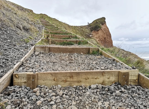
- Varied Landscape: The trail features challenging climbs and descents on the moors and cliffs, as well as easier stretches through woodland and villages. Be prepared for uneven ground, muddy sections (especially after rain), and rocky paths.
- Waymarking: The Cleveland Way is generally well-waymarked with acorn symbols (the National Trails logo). However, always carry a map and compass/GPS and know how to use them, especially on the vast, less defined moorland sections.
- Coastal Erosion: Be aware that coastal paths can be affected by erosion. Always stick to the marked trail and heed any warning signs.
essential supplies
- Carry Enough Water & Food: Water refill points are limited, particularly on moorland sections. Plan your intake and carry more than you think you'll need for yourself, and any pets accompanying you. Don't rely on finding shops or cafes directly on the trail; pack enough snacks for the day.
- Research Dining Options: Look into villages along your route for pubs and cafes where you can grab a meal or a drink, especially at lunchtime or in the evenings. If you're bringing a pet, ensure you research pet-friendly establishments.
respect the environment
- Stick to the Path: This protects fragile ecosystems, prevents erosion, and respects private land.
- Take All Rubbish Home: Leave nothing behind.
- Be Mindful of Livestock: Keep dogs on a lead near farm animals. Close gates behind you.
- Fires: Never light fires, especially on the moors, due to severe fire risk.
- Noise: Be considerate of wildlife and other walkers.
transport options
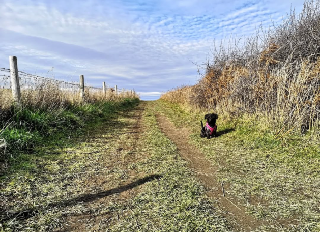
- Bus Services: Many coastal and moorland villages are served by local bus routes, which can be useful for reaching start/end points of day walks or returning to your accommodation. For a shorter, manageable walk, we highly recommend the Whitby to Robin Hood's Bay section of the Cleveland Way. This approximately 6.8-mile stretch typically takes 2.5-3 hours. We found it worked perfectly to walk one-way and use the bus for the return trip; the service is very convenient, dropping you centrally in Whitby and picking up near Robin Hood's Bay's Hotel Victoria.
- Train: The Esk Valley Railway serves several villages between Whitby and Middlesbrough, which can be useful for accessing parts of the eastern section.
miles without stiles: accessibility along the cleveland way
"Miles without Stiles" routes in the North York Moors National Park are carefully assessed and graded to help visitors choose walks suitable for their abilities. These grades are categorised as 'for all', 'for many', or 'for some', primarily based on the gradients encountered along the path and the surface conditions of the trail.
- 'For all' routes are designed to be accessible to almost everyone, including independent wheelchair users and families with standard pushchairs. They typically feature very gentle gradients (no steeper than 1:10) and smooth, well-maintained surfaces.
- 'For many' routes are suitable for assisted wheelchair users and families with more robust pushchairs or buggies. These may have slightly rougher surfaces and steeper sections (up to a 1:8 gradient), requiring a bit more effort.
- 'For some' routes are intended for stronger wheelchair users, individuals with good mobility but perhaps requiring assistance, or those with off-road mobility scooters. These paths may include steeper gradients and more challenging, uneven surfaces or minor obstacles.
It's crucial to remember that these grades serve as a guide only. Personal ability, weather conditions, and the specific type of equipment (e.g. wheelchair model) can all influence a walk's suitability. Therefore, before embarking on any route, it's highly recommended to read through each walk's specific details (below) to get a comprehensive understanding of the terrain, features, and any additional advice, allowing you to weigh up your route choice carefully and ensure a safe and enjoyable experience.
nettledale linear
Discover Nettledale's charming 1-mile "Miles without Stiles" walk (rated 'For Many') on the Cleveland Way, just outside Helmsley. This easy, out-and-back trail meanders along a mostly level, stoned track through woodlands, past scenic ponds, and to an enchanting glade with stepping stones. While the path can be a bit rough in spots, it's perfect for a quick escape. Find limited parking at the trailhead, with accessible toilets and cafes conveniently located in nearby Helmsley.
robin hood's bay linear
Get ready for jaw-dropping coastal views on this 1-mile "Miles without Stiles (For Many) walk near Robin Hood's Bay! This out-and-back route on the Cleveland Way delivers spectacular vistas over the bay and Ravenscar cliffs, even stretching to Flamborough Headland on clear days. The path is mostly surfaced and about 1 metre wide, though expect some rougher limestone spots and short gradients up to 1:10. Start at the Station Road car park (where you'll find accessible toilets, closed in winter) and grab refreshments with ramped access at the Grosvenor or Victoria Hotels. This walk is pure coastal magic!
ravenscar circular
Hit the dramatic coast at Ravenscar with this 1.5-mile "Miles without Stiles (For Some) route! Explore two loops: the northern loop is smooth sailing for pushchairs, wheelchairs, and mobility scooters. The southern loop wows with cliff-edge views and wildflowers, but beware a 1:10 incline and two kissing gates that might challenge some mobility aids. Paths are mostly compact earth or grass, a bit rough in spots. Start from Station Square (accessible toilet here!), then refuel at the accessible Ravenscar Tearooms or Raven Hall Hotel. Don't miss the fascinating "resort that never was" and the accessible National Trust Coastal Centre!
runswick bay linear
Runswick Bay's "Miles Without Stiles" coastal stroll is a breezy 1.2-mile out-and-back walk, dishing out incredible views across the bay from the Cleveland Way. Starting from the Pay & Display car park, expect a mostly level path blending smooth aggregate with some slightly rougher grassy stretches. Generally accessible, just watch for a few uneven bits. Grab refreshments at Cliffemount or Runswick Bay Hotels, and find accessible toilets at Staithes Top car park.
sutton bank circular
Get ready for a 5¼ mile (8.5 km) adventure from Sutton Bank, crafted specifically for wheelchairs, mobility scooters, handcycles, and mountain trikes! This route links the Cleveland Way with the thrilling 'Cliff' cycle path, serving up outstanding views of the Vale of Mowbray and the distant Yorkshire Dales. While mostly level, expect a few climbs (up to 1:8 short, 1:13 longer) and be aware that surfaces can get rough or muddy after rain. Rated Category 2 by Disabled Ramblers, this walk is a fantastic accessible challenge. You'll find accessible toilets and refreshments at Sutton Bank, plus a café (with outdoor seating) and a weight-bearing toilet at the Yorkshire Gliding Club. Looking for something shorter? Stick to the Cleveland Way sections directly north or south of Sutton Bank.
Hambleton drove road
Experience a stunning 1.5-mile out-and-back stroll along the Hambleton Hills escarpment, offering distant views to the Yorkshire Dales. This "Miles without Stiles (For Some)" route starts on the historic Drove Road, then transitions to a grassy track with a 1:15 incline before leveling out. Keep an eye out for ancient artifacts along the Drove Road and the ruins of Limekiln House, a former drovers' inn. For the truly adventurous, push on through a gate for an outstanding view over hidden Thorodale. While the path can be rough and narrow past the gate, August is prime time when the heather explodes in full bloom. Limited roadside parking is available near Kepwick; follow signs for the "Unsuitable for motors" road (it's fine for cars to the parking spot!). The closest accessible facilities are in Thirsk and Osmotherley.